We ventured south of the border to Baja Mexico for our first time, in January 2022. As with any trip, a big portion of it is the planning and anticipation, but for this trip, being it involved leaving the country and venturing to a place we hadn’t been, then throw in the fact that there’s another language involved, well, there was a bit of work too do to prep for this trip. This post will cover a bit of trip prep for Baja as well as our experience crossing the border, then we’ll get to the actual trip in following posts. Hopefully this post will be useful to those who are considering or planning a trip in the future.
Trip Prep
We started planning our trip back in 2019, with plans to make the trip in November 2020. Then the pandemic came along and threw a wrench in the works. Prior to cancelling our trip due to the pandemic we had purchased books, started reading up on the area, and also geared up with some saltwater fishing gear. We also started attempting to learn Spanish. Emphasis on attempting. Once we cancelled the trip the few words and phrases we learned were lost and we never really picked it back up. Google Translate helped a bit here and there, but thankfully the people of Baja are patient and kind, and we made it through just fine. Next time I’ll know a few more words!
Books

A few of the books we used as resources included:
- Benchmarks Baja California Road and Recreation Atlas
- Moon’s “Baja – Tijuana to Los Cabos” – Jennifer Kramer
- The Baja Adventure Book – Walt Peterson
- Camping Mexico’s Baja, 6th Edition – Mike and Terri Church
- The Baja Catch – Neil Kelly & Gene Kira
- Hooked on Baja – Tom Gatch
- Fly Fishing the Baja and Beyond – Mike Rieser
- Fly Fishing Southern Baja – Gary Graham
Some of these books are out of print and we found them used. Others seemed to be out of date. I’m not sure if there have been big changes in what exists today compared to pre-pandemic, or if Baja just changes a lot by its nature. Either way, just a note of caution that even if you have the latest travel guide, don’t expect every business to still be open, or that you will be able to find it. We searched for a few “best taco places in _____” that books and guides pointed us towards and the common theme was that they were nowhere to be found. That said, part of the best stuff in adventure travel happens when you aren’t planning everything out. That’s why it’s an adventure!
Maps

Once we re-set our trip planning to January 2022 it was time to start getting some waypoints on the map so we weren’t completely lost. With two weeks in Baja we mainly just planned to keep travelling south until we ran out of time, then turn around and start north again. We did pick out a few areas we wanted to see as we travelled south. From there we started putting those points on the map. That’s where Gaia GPS comes in. We put in a few camping prospects and several other points of interest, then added the National Geographic Baja map, along with the Gaia topo base layer, downloaded the whole thing to the phone and that was the basis for our trip planning in the evenings for the next days adventure. In addition, we downloaded an offline version of Google Maps for the entirety of Baja. Both these solutions work entirely offline if you prepare in advance. We didn’t know where we would have coverage and where we wouldn’t, but if we happened to be offline for several days we would still have all the navigational tools we would need. In addition to navigation the other mapping app we used was iOverlander. This was a key tool to assist in finding places to camp. It’s not always clear where you can and can’t camp, or if you should expect to pay or not. iOverlander answers a lot of those questions, and with short days we didn’t want to spend a lot of time hunting for camps. Note above in the books section, we did also have a Benchmark map book that covers the entire peninsula. Don’t ever rely completely on technology for something as essential as navigation.
Other Considerations
There’s some pretty universal recommendations you find during research that we followed. These included:
- Passports – make sure your passport isn’t going to expire while you’re there
- Obtain a FMM – This is your “tourist permit” that allows you to stay in the Country for up to 6 months – we got ours in advance online, if you do that be sure to print both the FMM and the receipt, having one without the other will not work.
- Obtain Mexican auto insurance – there’s a few places to get this – it turns out if you are going to be there for long you might just buy the insurance for the entire year.
- Copies of other important documents – truck title, ID’s, etc. We brought paper copies as well as saved documents to a offline Google Drive folder. We didn’t need any of this, but I’d hate to get into a situation where we needed it and didn’t have it.
- Advance reservations – just kidding on this one – we didn’t even know for sure where we were going to stay on night one until we pulled in and shut off the engine. We made no advance reservations, and when we tried in the case of a whale watching trip they told us to call them the day before to see if they were going out. Baja is perfect for those that don’t like to make too many plans.
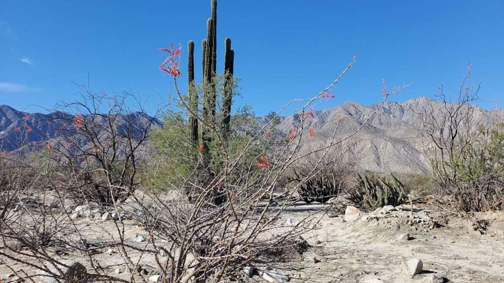
- Don’t plan to drive at night. We had one night where we had to break this rule, but for trip planning purposes, don’t travel at night. This becomes evident when you see the roads in Baja. It had rained just prior to our arrival and several roads had large washouts that would destroy your vehicle, some marked with old tires if they were marked at all. In addition, there is livestock grazing along roads pretty much everywhere. Add to that the topes (large speed bumps) in random locations, and paved surfaces barely wide enough for vehicles to pass and it’s just not a recipe for success to be out after dark.


Crossing the Border
We summed up our experience crossing the border in the video below (and while your watching please subscribe to the channel for future updates!). In short, we had no issues. We didn’t take much food in for fear it would be confiscated, but our belongings were given a cursory glance and we were in Mexico – easy as pie. We crossed at Tecate to avoid the busier crossings and it worked well for us. It was quiet on New Years morning and we were on our way in no time. Getting back in to the US was another story, but that’s for later.
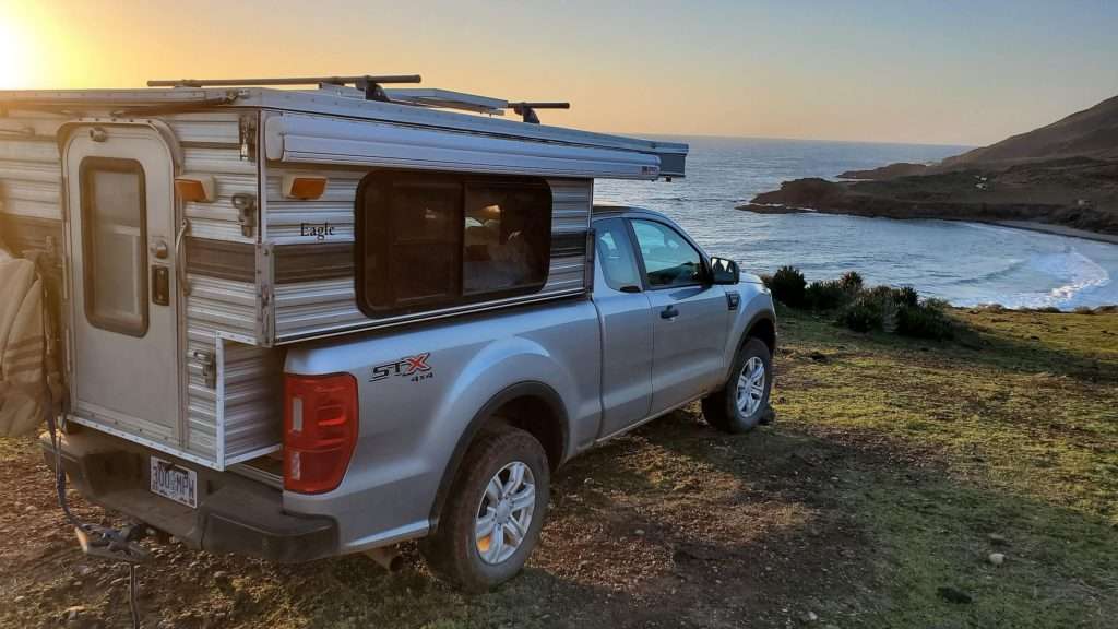
Once across the border we did some grocery shopping, acquired a few thousand pesos and headed south out of busy Ensenada to find a quiet spot to watch the sun set over the Pacific.

An now that we’ve got all these logistical considerations out of the way, we’ll pick up there in part 2! If I missed something you were wondering about for your trip planning, leave a comment below and we’ll get back to you.

Pingback: El Camino del Diablo – Occidentalist